| NAMADGI FOOTPADS
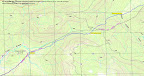
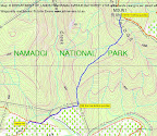
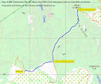
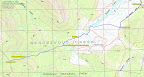
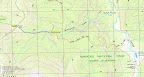
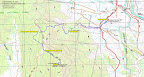
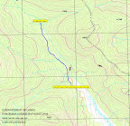
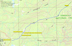
Here's details of a few Namadgi footpads which can quickly get you places. Use the details carefully - all guides (be they man-made or even natural) change. Always be equipped with map and compass (and know how to use them) and know where you're coming from and where you're going to. If anyone would like to contribute information to this resource, they'd be most welcome. Email me to open discussion. Map 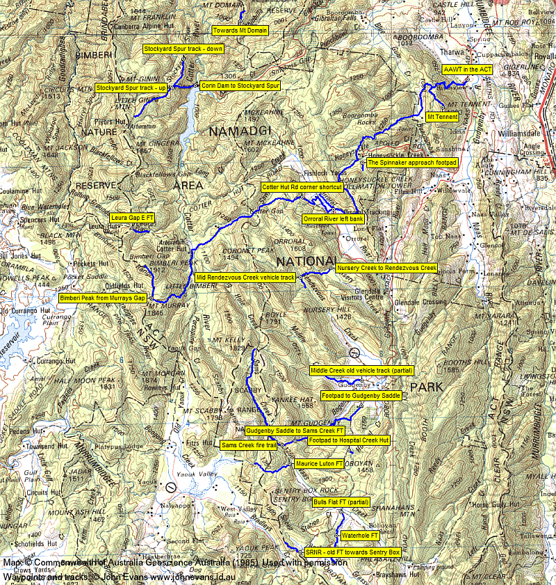
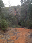
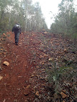
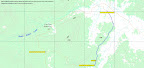
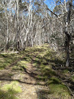
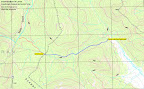
NB Click on any thumbnail map or photo for a larger version Index
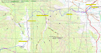
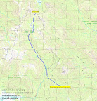
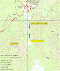
1 AAWT from Namadgi Visitors Centre to Murrays Gap
General description: This route commences at the Namadgi Visitors Centre and finishes at Murrays Gap on the NSW/ACT border. It uses footpads and management trails. There is little signage in the Bimberi Wilderness west of the Cotter Hut Rd. Start: Namadgi Visitors Centre at UTM 55H 687284-6066083 (MGA94) (outer car park at UTM 55H 687292-6066198 (MGA94)) Detailed description:
Recent use: Parts of it on 8 Dec 12, 9 Oct 12, 8 May 12, 24 Mar 12, 15-16 Oct 11. Most of it on 4 Feb 12. 2 Bimberi Peak footpad from Murrays Gap
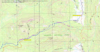
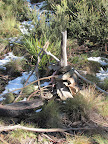
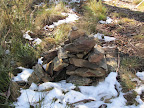
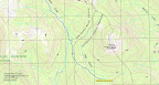
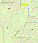
General description: This route commences on the N side of Murrays Gap and ascends to Bimberi Peak via a heavily cairned (and orange tape as at 5-6 Apr 13) footpad. Start: A small cairn (and orange tape as at 5-6 Apr 13) just on the edge of the tree line on the N side of Murrays Gap at UTM 55H 662563-6049866 (MGA94) Detailed description: The footpad is heavily cairned (and orange tape as at 5-6 Apr 13). It climbs gently through open forest from the timbered N edge of Murrays Gap from 1520m to 1600m. Border marker E76 is right beside the pad at UTM 55H 662669-6050144 (MGA94). It then climbs more steeply to 1800m. Some portions of the footpad are stony. The pad generally follows the ACT-NSW border. Border marker S75 is right beside the pad at UTM 55H 662690-6051299 (MGA94). There are, however, some multiple, braided, cairned pads, so one still needs to be careful. At around 1800m it swings from generally N-ish (going up) to NW-ish and climbs more gently via a lovely open, sub alpine spur through Snow Gums. The footpad is routed through border marker G75 at UTM 55H 662178-6052271 (MGA94) to Bimberi Peak at 1911m. The trig can be seen from a few hundred metres away. Recent use: 25 Apr 13, 5-6 Apr 13, 4 Feb 12. 3 Mt Blundell descent towards Pabral Rd
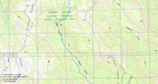
The old fire trail is not shown on the first or second edition Cotter Dam 1:25000 topographic map. It is shown on the Cotter Dam OZraster digital map. General description: This old fire trail commences at Mt Blundell and heads SW down a spur to the edge of NNP. From the bottom, moguled fire trails head generally W-ish to meet Pabral Rd. It appears (14 May 13) to be well maintained, with cleared vegetation and sawn off sapling stumps. Start: Fire trail junction at Mt Blundell at UTM 55H 668325-6092806 (MGA94) Detailed description: Follow your nose. Steep in places.
Recent use: 14 May 13, 26 Aug 08.
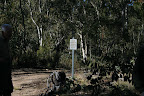
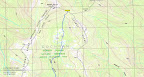
General description: This fire trail commences near the complex intersection of Sams Creek FT and the Old Boboyan Rd. It heads generally S to an intersection with the Waterholes FT, then heads W-ish to join the Grassy Creek FT. Start: Fire trail junction marked with signage, just S of the Old Boboyan Rd ford over Naas Creek, at UTM 55H 676744-6033009 (MGA94) Detailed description: Check the new fire trail metal signs to ensure that you're on the correct fire trail, then follow your nose. Call in at the stockyards on the side of the FT at UTM 55H 676386-6031358 (MGA94).
Recent use: 8-9 Sep 12.
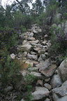
THIS FOOTPAD HAS BEEN UPGRADED AND IT NOW AN EASY TO FOLLOW TRACK. General description: This route commences opposite the Corin Dam toilet block and ascends a spur to join the Stockyard Spur track at a helicopter landing pad/turnaround circle. Start: New steps (the 4 steps represent the 4 rises in the track and the seat is for either pre-walk contemplation or post-walk recovery!) on the other side of the road down to the picnic area from the Corin Dam toilets UTM 55H 666341-6066179 (MGA94) New track Detailed description: Start at the steps opposite the Corin Dam toilets. The upgraded track commences as a swathe through nicely cleared pea regrowth. A zig and a zag - you can't go wrong. A series of timber steps, then some stone steps. Occasional timber steps as the track rises. Again, just follow your nose. This track is usable at night time with a torch (came down on the night of 27 Oct 12). There is a large, cleared helicopter landing pad and vehicle turnaround at the top.
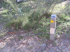
Recent use: 27 Oct 12, 13 Oct 12, 30 Jun 12. Old track Detailed description: Step up the little bank on the other side of the road down to the picnic area from the Corin Dam toilets. After a couple of metres climb over a large tree trunk across the footpad. There are a few tapes and the footpad zigs then zags up through patches of tall pea regrowth, including along an old benched road. Be careful of the next turn - after around 40m on the zag, turn right up a steep incline. There are a couple of old fuel stove only and track signs on posts in the bush. Turn right again onto the footpad. It rises in a further 3 steep pinches. The start is at 940m and the top at 1490m, so that's a climb of 550m over 2.2km. The footpad is quite well used and clearly defined. Where it joins the Stockyard Spur track, there is a small rock cairn beside the footpad and another in the middle of the Stockyard Spur track. Comment: Around 2006 a lone bush runner was lost and presumably died in this area. There are plans to clear 5m each side of this footpad to make an escape route for firefighters.
Recent use: 28 Jun 11, 5 Feb 11, 12 Jun 10, 11 May 10, 10 Apr 10, 5 Sep 09, 19 May 09, 18 Apr 09, 14 Apr 09, 24 Mar 09, ... 6 Cotter Hut Road corner shortcut
General description: This route cuts the sharp corner in the Cotter Hut Road around 4km NW of the Orroral Tracking Station car park Bottom of shortcut: Gully at UTM 55H 674361-6057364 (MGA94). Watch for the large blackened stump. Small rock cairn against stump. Detailed description: Follow the footpad - it's quite distinct.
Recent use: 17 Nov 12, 13 Nov 10, 19 Oct 10, 1-4 Oct 10, 22 May 10, 11 Aug 09, 11 Oct 08, ....
General description: A realigned portion of the Grassy Creek fire trail extending from near Westermans Hut, generally paralleling the border, to the NW-NE bend at the Scabby Range Nature Reserve. Start: Near Westermans Hut Detailed description: The new Grassy Creek fire trail must diverge from the original near Westermans Hut. I've joined it by continuing up the slope from the Westerman graves. It climbs SW up a drainage line towards the border, swinging NW to parallel it. There is a fire trail link of a few tens of metres which joins a fire trail on the NSW side of the border, at the NSW Portion Survey reference tree at UTM 55H 676597-6026461 (MGA94). The new Grassy Creek ft continues, dropping away from the border for a time, then looping to join it N of SH1314. Drop log fencing can be seen a little further on. It continues NW along the border and there is a junction with the original Grassy Creek ft (the junction is marked) at UTM 55H 674302-6029061 (MGA94). From here it continues generally NW until the NW-NE turn in the original Grassy Creek fire trail. At this end point of the realignment, there is a short section leading to a gate into the Scabby Range Nature Reserve.
Recent use: 8-9 Sep 12, 15 Mar 11, 20 Jul 10.
General description: This route commences at the Yankee Hat car park and follows the Old Boboyan Road, then fire trails and finally an open feeder creek to an arm of Bogong Creek to the tree line. A taped footpad goes generally SW to the saddle SE below Mt Gudgenby Start of footpad: an old yellow tape (fallen to the ground, I think) and new blue tape at the top of an open lead above a Bogong Creek drainage line UTM 55H 675386-6039269 (MGA94) Detailed description: Follow the Old Boboyan Road SW from the car park for 1.4km. Turn W (right) at UTM 55H 677634-6040078 (MGA94) onto a fire trail which is not marked on the Yaouk 8626-2N 1:25000 Second Edition 1:25000 map (but it is marked on the First Edition map). Follow the fire trail W and SW to near Bogong Creek. Cross the fire trail coming from near Frank and Jacks Hut and heading across the more recently made Bogong Creek culvert (the bridge crossing marked on the First Edn map does not exist any more). Follow the fire trail above the SE side of the top of Bogong Creek to a bend at UTM 55H 675854-6039615 (MGA94). This is where you leave the fire trail, crossing old fencing lying on the ground and a large roll of old netting. Make your way generally SW down across the drainage line and gently up through the open lead to the tapes at the top of the cleared area at UTM 55H 675386-6039269 (MGA94).
Recent use: 7-8 Jul 12, 3 Sep 11, 30 Aug 11, 14 Sep 10, 12 Jul 10, 8 May 10, 9 Mar 10, 19 Sep 09, 21 Jul 09, ... 9 Gudgenby Saddle to Sams Creek fire trail
General description: Starts at the saddle SE of Mt Gudgenby and follows a drainage line WSW down to cross the Naas Creek and join the Sams Creek fire trail Detailed description: The footpad (indistinct in places) starts at the Gudgenby Saddle (taped from the starting cairn across the saddle, then the tapes stop) and follows a drainage line on its SE side down to the Naas Creek (I tend to stay high going down and close to the drainage line coming up). A drop of around 60m. Cross the Naas Creek and continue WSW a further 100m to intersect the indistinct Sams Creek fire trail at the double blue tapes.
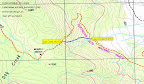
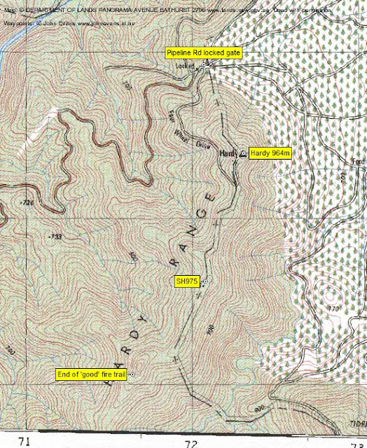
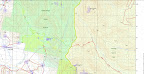
Recent use: 7-8 Jul 12, 3 Sep 11, 30 Aug 11, 28 Sep 10, 14 Sep 10, 12 Jul 10, 19 Sep 09, 21 Jul 09, 8-9 Jul 06, 2-3 Jan 06, 16 Oct 04. 10 Fire Trails around Hardy Hill A note on the fire trails around Hardy Hill: 1 The Cotter Dam 8627-2N Second Edition 1:25000 topographic map shows no fire trails directly South of Hardy Hill. The left map segment below shows the track for 2013 06 18 Hardy trig section (blue) and part of the track for 2009 05 12 Hardy Range to Camels Hump 2 The Cotter Dam 8627-2N First Edition 1:25000 topographic map in the centre shows only the beginning of the Hardy Range crest old fire trail (marked 'Four Wheel Drive') 2 The OZraster digital map (prepared from NSW LPI date in 2011) segment on the right shows the full extent of the Hardy Range crest old fire trail. It also shows a trail from near the locked gate to Hardy trig. We may have been just East of this on 18 Jun 13, touching on it near the trig
Recent use: 18 Jun 13, 12 May 09, 11 Aug 07. 11 (Footpad to) Hospital Creek Hut
General description: This footpad commences from the Old Boboyan Road and goes generally ESE to the Hospital Creek Hut Start of footpad: intersection of old vehicle track and Old Boboyan Road UTM 55H 677481-6037749 (MGA94) Detailed description: The route begins at the E side of the Old Boboyan Road, around 1.9km S of the turnoff to Frank and Jacks Hut, at UTM 55H 677481-6037749 (MGA94). Initially an faint old vehicle track, soon deteriorating into a footpad. Comes in at the side and back of Hospital Creek Hut.
Recent use: 27 Mar 12, 3 Sep 11, 9 Mar 10.
General description: This management trail commences at Leura Gap and goes down to join the Mt Franklin fire trail Start of trail: Leura Gap and around UTM 55H 661204-6055305 (MGA94) Detailed description: The route begins at the gate at Leura Gap and generally follows the line of the fire trail on the 1st edn map. It ends at the intersection with the Mt Franklin fire trail where you can get water from McKeahnie Creek. It is not shown on the 2nd edn map. (There is also a management trail going W into the Bimberi Nature Reserve.)
Recent use: 27 Oct 12, 9-10 Jan 09.
General description: The Maurice Luton fire trail runs from its intersection with Sams Creek fire trail (S of Mt Gudgenby and at the top of the Naas Creek/Boboyan Valley) generally SW and W to the ACT-NSW border. It continues on in the NSW Scabby Range Nature Reserve and heads NW to the Rowleys Hut at Yaouk.) Detailed description: The start of the fire trail is well signposted at a cleared area. The Maurice Luton fire trail is a well made construct, climbing 100m beside a drainage line to the ACT-NSW border.
Recent use: 30 Aug 11 (from junction with Sams Creek fire trail to ACT-NSW border), 14 Sep 10 (from junction with Sams Creek fire trail to ACT-NSW border), 21 Jul 09. 14 Middle Creek old vehicle track - partial
General description: This old vehicle track starts at Gudgenby Homestead and heads generally West, crosses Middle Creek and ends near the tree line in the mouth of Middle Creek. Detailed description: I don't have a GPS record of the first part of this old vehicle track, but you can see it leaving Gudgenby Homestead on Google Earth. It heads generally West-ish to the 1000m contour, then across a new concrete bridge over Middle Creek. It passes J Rustins Hut site (UTM 55H 677060-6043143 (MGA94)) at the kink in the fence line. It passes near the Middle Creek cascades and axe-grinding groove (UTM 55H 676795-6043204 (MGA94)) as it parallels Middle Creek near its South bank. It ends at a tape on a bush, a few tens of metres from Middle Creek where one crosses to the Middle Creek indigenous rock shelter (UTM 55H 675730-6043594 (MGA94).
Recent use: 16 Apr 13 (some), 1 Dec 12. 15 Namadgi Visitors Centre to Mt Tennent
General description: This route commences at the Namadgi Visitors Centre and climbs 800m to Mt Tennent using a combination of AAWT (realigned in places), old vehicle track, footpad and Mt Tennent Fire Trail Start of footpad: Namadgi Visitors Centre UTM 55H 687176-6065974 (MGA94). If you are returning after the (inner) gates are closed at 4pm, park in the area between those inner gates and the road Detailed description: Starting from the Namadgi Visitors Centre, the AAWT goes 600m along over the wooden bridge and up through the woodland via formed gravel tracks to cross the Naas Road (watch out for vehicles!). A further 1.9km and 160m climb along well-worn track and footpad gets you to Cypress Pine Lookout. From here, 2.4km and 340m climb along the AAWT brings you to a T-intersection on the NW ridge to Mt Tennent. There are sections of stone staircases, which are beautifully framed by wildflowers in Spring. Note that the AAWT has been fairly significantly realigned since the publication of the Williamsdale 8726-4N 1:25000 second edition map.(From here, the AAWT on its new alignment continues to the right (NW), swinging around and going down to Bushfold Flats.) Go left (generally S, but actually SW then SE) along footpad and old vehicle track for 1.3km, first descending then ascending around 100m. This finally brings you through a clearing (at the top of Tong's sheep yard site) and to the intersection with the Mt Tennent Fire Trail at UTM 55H 684681-6064529 (MGA94). Turn half left onto it and trudge uphill for 1.1km, climbing a further 160m.
Recent use: 7 Oct 12, 19 May 12 (part), 28 Jan 12, 28 May 11, 19 Feb 11, 15 May 10, 8 Sep 09, 16 Dec 08, 27 Dec 07, 31 Jul 07, 21 Oct 05, 17 Apr 04, 15 Mar 04.
General description: This route commences by crossing the Orroral River down from Rowleys Orroral Hut site, then follows an old vehicle track downstream, around 140m up from the river bank. It clears the light tree cover near the huge boulder, within sight of the Orroral River bridge carrying the Link Track (AAWT). Start: Cross the Orroral River via the remnants of the old footbridge (W-G site OR12), which has been washed downstream to UTM 55H 675680-6057508 (MGA94). The crossing can be found 200m from Rowleys Orroral Valley Hut site on a bearing of 42°M. Detailed description: After crossing the Orroral River, head up from the river bank, then turn downstream. Animal pads lead to an old vehicle track (if you're fortunate enough to strike it); if not found, just continue SE through the generally open going. The last third of the route is through light timber, coming out into the open within view of the huge boulder and the Orroral River bridge and Link Track. It may be difficult to find the old vehicle track when traversing this route in the upstream direction.
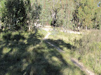
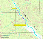
17 (Orroral Valley) Nursery Creek to Rendezvous Creek
General description: This route commences at the Nursery Swamp car park on the Orroral Road and initially follows the Nursery Swamp Walking Track. Cross the bridge over Nursery Creek and, at a distinct U-bend in the Track (the 'Rob H turnoff' - I always used to leave the track above Nursery Creek and cross Nursery Creek), walk West and pick up the footpad which goes West to the saddle then down to Rendezvous Creek. Start: Distinct U-bend in Nursery Swamp Walking Track around 275m on from the bridge over Nursery Creek UTM 55H 676365-6051532 (MGA94) (alternative start point was Major bend in Nursery Swamp Walking Track above Nursery Creek UTM 55H 676433-6051856 (MGA94)) Detailed description: Cross the bridge over Nursery Creek and continue for around 275m along the Track to a distinct U-bend at UTM 55H 676365-6051532 (MGA94). Head 251°magnetic for around 210m. (alternative start: After climbing to the high point above Nursery Creek, the Nursery Swamp Walking Track takes a turn to the South. There is a burnt and blackened marker post on the NW side of the turn. A few tens of metres down the track, leave it to the SW and go down to cross Nursery Creek. Head for a large pig trap at UTM 55H 676270-6051646 (MGA94). Round the finger of bush to its W and continue heading SW across the pig-rooted flats.) You need to find a blue painted branch down near ground level marking the start of the footpad at UTM 55H 676146-6051529 (MGA94). It's hard to see the blue paint in the wet. The footpad heads West, paralleling Nursery Creek to the saddle between SH1424 and SH1373. It is marked by blue paint daubs (the old and new tapes have been removed). On 21 May 13 I noticed a number of new pink tapes (2 slightly misplaced) which are very helpful. I can still manage to lose the pad several times each journey. From the saddle it descends to Rendezvous Creek, passing through a large patch of pea regrowth and following a zig-zag down the slope. You can see the remains of a bridge over the creek, just the bearers remaining. Cross the Rendezvous Creek flats to a well defined fire place on the West bank at UTM 55H 674054-6051198 (MGA94). Comment: Around 2007 a lone and poorly equipped walker was lost in this area for 3 days. The footpad was additionally taped soon afterwards. The route follows an old bridle track from Orroral to Rendezvous Creek and is W-G site OR22.
Recent use: 21 May 13, 17 Nov 12, 3 Jul 12, 15 May 12, 22 Feb 11, 26 Oct 10, 22 Dec 09, 24 Nov 09, 3 Oct 09, ... 18 (Mid) Rendezvous Creek vehicle track
General description: This route commences at the fire place on the W side of Rendezvous Creek and heads generally parallel SSE down the W side of Rendezvous Creek. And further. Start: Fireplace on West bank of Rendezvous Creek UTM 55H 674054-6051198 (MGA94) Detailed description: An old vehicle track which starts at the fire place on the W side of Rendezvous Creek. It parallels the creek for around 1km to the edge of the open flats. The track ends at a little creek flowing down from the SW. There must have been another little bridge here, as the creek bottom is packed with a number of cross logs. The track goes a lot further S, indistinct in places. It may cross Rendezvous Creek arount UTM 55H 675206-6049458 (MGA94). We were on it at UTM55H 675657-6048761 (MGA94). In May 12, there was tape marking the exit from/entry to timber at the N end of the Rendezvous Creek cleared valley at UTM 55H 675873-6048433 (MGA94).
Recent use: 15 May 12, 26 Oct 10, 22 Dec 09, 24 Nov 09, 28 Jun 06.
General description: This route commences at Fishing Gap and climbs to the SE nose of the ridge through SH1402 which approaches Mt Domain. Start: Fishing Gap. First pink tape just in the tree line at UTM 55H 669905-6071059 (MGA94) Detailed description: The route was taped on 17Jul10 and takes a sensible line towards Mt Domain. The first pink tape is just in the tree line at Fishing Gap and the route proceeds generally N. Instead of climbing the spur through large granite and regrowth, it continues N up the flank of the ridge. It eventually turns NE and climbs to the nose, including across a small scree slope. The last tape is just SW of the crest of the ridge. I've heard polarised views on taping routes, but I think this pink taping from Fishing Gap to the top of the first rise, around the flank to avoid heavy granite and regrowth, was a good move. Whether others do will be signaled by whether the tapes stay and a useful footpad develops, or they are removed. In addition, the taping doesn't spoil all the fun - there's plenty of navigational challenges and regrowth along the ridge to SH1402 and from SH1402 to Mt Domain.
Recent use: 28 Aug 12, 17Jul10. General description: Sams Creek fire trail begins at a bend in the Old Boboyan Road and extends generally NW through a variety of going and in various conditions to a nominal end point at the Kelly saddle. 1 Old Boboyan Road (UTM 55H 676822-6033138 (MGA94)) to junction with Maurice Luton fire trail (UTM 55H 672899-6036814 (MGA94))Detailed description:
Recent use:7-8 Jul 12 (Kelly Saddle S to double blue tapes), 3 Sep 11(double blue S to Maurice Luton fire trail junction), 30 Aug 11 (double blue S to Maurice Luton fire trail junction; return), 28 Sep 10 (double blue NW to leave the ft just N of SH1373 to go to BM N83), 14 Sep 10 (double blue S to Maurice Luton fire trail junction; return from near BM Rb83 S to double blue), 13 Jul 10 (Sams Creek ford S to Old Boboyan Road), 12 Jul 10 (double blue N to Sams Creek ford), 19 Sep 09 (double blue N to Kelly saddle), 8-9 Jul 06 (Sams Creek ford S to double blue), 2-3 Jan 06 (double blue N to Kelly saddle). 21 Scabby Range Nature Reserve old fire trail towards Sentry Box
General description: This route commences at the gate into the Scabby Range Nature Reserve (near the W extent of the Grassy Creek Fire Trail) and heads generally NW up the spur towards Sentry Box Mountain until petering out just N of SH1357. Start: Gate into the Scabby Range Nature Reserve UTM 55H 673403-6030017 (MGA94). Reach this gate from the 130m long link fire trail which joins it to the W-most extent of the Grassy Creek fire trail at UTM 55H 673508-6029979 (MGA94). Detailed description: An old fire trail, in NSW, which parallels the border up the gentle spur towards Sentry Box Mountain through unburnt eucalypt forest. Around 160m in from the gate, at UTM 55H 673260-6030092 (MGA94), there is a junction. Going up, take the right (North) leg here; coming down, take the left (East) leg here. There is fallen timber across the fire trail in several places. Look up and see the gap in the large trees to follow it.
Recent use: 8-9 Sep 12, 15 Mar 11. 22 The Spinnaker approach footpad
General description: This route commences at a bend in the fire trail to the tanks above Honeysuckle Creek camping ground and goes S for 600m to an open frost hollow. Start: Footpad leaves the fire trail at UTM 55H 679065-6059893 (MGA94) Detailed description: A well-worn footpad.
Recent use: 19 Mar 13, 8 Oct 11. 23 Stockyard Spur track - down
General description: This route commences at a set of small cairns at the intersection of the footpad coming up from Corin Dam (now a large helipad since the upgrade in 2012) and heads NNE down the spur until petering out. Start: 2 small cairns, one near and one on the Stockyard Spur track (now a large helipad since the upgrade in 2012) UTM 55H 664548-6066035 (MGA94) Detailed description: An old vehicle track, this segment starting at the cairns (now a large helipad since the upgrade in 2012) and heading generally NNE down Stockyard Spur until it peters out. Varies between reasonably well defined and poorly defined.
Recent use: 10 Apr 10, 24 Mar 09, 15 May 07.
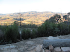
General description: This route commences at the helicopter landing pad/turnaround circle at the intersection of the footpad coming up from Corin Dam and heads SW up the spur to meet the Mt Franklin Road. Start: Helicopter landing pad/turnaround circle UTM 55H 664548-6066035 (MGA94) Detailed description: An old vehicle track, refurbished 2012 to allow vehicle access, this segment starting at the helicopter landing pad/turnaround circle and heading generally SW up Stockyard Spur to meet the Mt Franklin Road at a marker pole. Well defined and a lovely walk through snow gums. A 40m climb to SH1532, down through a saddle, a 120m climb to near SH1615, a further 90m climb. (At UTM 55H 662209-6064421 (MGA94), a few tens of metres to the NW of the vehicle track via a footpad, is a slab area providing great views to the NW including Mt Ginini. Back on the vehicle track and a few metres on, is a faint footpad to the left for 20m to what Graeme Barrow dubbed 'Stockyard Spur Grandstand' at UTM 55H 662235-6064345 (MGA94). Excellent views to the E and SE including Mt McKeahnie.) Back on the vehicle track, a further a 60m descent.
Recent use: 13 Oct 12, 30 Jun 12, 28 Jun 11, 5 Feb 11, 12 Jun 10, 11 May 10, 5 Sep 09, 19 May 09, 21 Apr 09, 18 Apr 09, 14 Apr 09, 21 Mar 09, ...
General description: This FT commences in the North at the junction with Bulls Flat FT and ends at Waterhole Hut. Start: Junction with Bulls Flat FT UTM 55H 676332-6031200 (MGA94) Detailed description: This fire trail is not marked on the 1st or 2nd edn Yaouk 1:25000 topographic map. It is marked on the OZraster series of maps. Just follow your nose.
Recent use:8-9 Sep 12 Back to Walks Index |
|||||||||||||||||||||||||||||||||||||||||||||||||||||||||||||||||||||||||||||||||||||||||||||||||||||||||||||||||||||||||||||||||||||||||||||||||||||||||||||||||||||||||||||||||||||||||||||||||||||||||||||||||||||||||||||||||||||||||||||||||||||||||||||||||||||||